Update as of 11:30 AM:
Tropical Storm Elsa's center has crossed the border into North Carolina as of the 11am advisory from the National Hurricane Center. Aside from a few residual rain bands, the worst of the weather is in North Carolina and headed for the Mid Atlantic states.
The Tropical Storm Warning continues north of South Santee River, but is likely to be discontinued later Thursday.
Update as of 9 AM:
The Tropical Storm Warning has been discontinued south of South Santee River, but continues in the Grand Strand for a few more hours.
The Tornado Watch has expired as of 9 AM.
Rain bands are beginning to exit the state and conditions are improving statewide.
Earlier story from 6:30 AM:
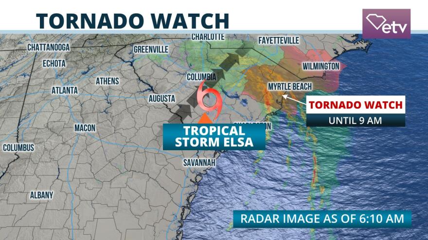
Heavy rain bands from Tropical Storm Elsa are pounding the coastal areas north of Charleston into the Grand Strand and Pee Dee regions Thursday morning, primarily with heavy rainfall. Several tornado warnings have been issued near the coast early Thursday morning from brief spin-ups within the spiral rain bands east of Elsa's center.
The center of Elsa was passing through Aiken, Barnwell, and Orangeburg counties early Thursday morning. As has been the case for much of its journey, the most impactful weather is east of the center. Top sustained winds were near 40 mph according to the 5am update from the National Hurricane Center and the tropical storm was moving northeast at 18 mph.

Tornado Watches continued until 9 AM from Florence eastward into the Grand Strand area from Georgetown county northward. Rain gauges and radar estimates are showing that 4 to 5 inches of rain had fallen in Jasper, Beaufort, and Charleston counties Wednesday night, and these amounts are expected farther northward into the Grand Strand Thursday morning and potentially as far west as Florence and Dillon counties. Small stream and urban flood advisories were in effect as far north and west as Columbia, where 1 to 3 inches of rain is forecast.
Some showers extended as far west as Anderson, Greenville, and Spartanburg counties, but effects from Elsa are expected to be far less in the Upstate than areas farther east and south.

The center of Elsa is expected to depart the state in Chesterfield or Lancaster counties around midday Thursday. The heaviest rain bands are likely to move out of Horry county at about the same time, but a few, brief residual rain bands are possible across the state Thursday afternoon before the weather associated with Elsa completely exits the state Thursday evening.
There are no other areas of tropical storm formation likely through at least the middle of next week across the Tropical Atlantic Ocean based on the Thursday morning forecast from the National Hurricane Center.


