Hurricane Earl, just south of Bermuda, and a nearly stationary front in the southeast US will keep combining to increase flooding and rip current hazards across parts of the state through this weekend.
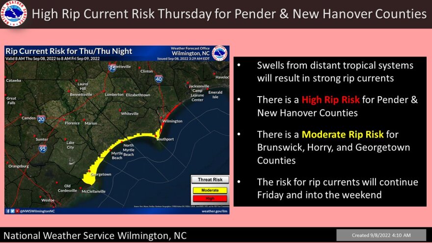
Category 2 Hurricane Earl is still forecasted to move northeast and stay well off the east coast, however powerful swells will cause a moderate to high risk of rip currents at many area beaches. The highest risk will be near the NC border with a moderate risk along the upper coast from North Myrtle Beach down to Georgetown. The lower coast will have a lower threat. If you decide to hit the South Carolina shores, consider staying in knee deep water or less until the threat decreases on Sunday. The Wilmington NWS also warns of rough surf and minor coastal flooding from Earl’s impacts.


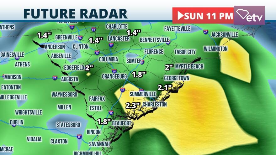
More significant flooding is possible through this weekend due a stationary front that will settle across Georgia the next 3-4 days. This pattern will cause rounds of heavy rain at times, especially across the Low Country and coastal areas where 2-4” of rain may fall through the weekend. Abnormal high tides due to Hurricane Earl may exacerbate the flooding situation along the coast. Elsewhere, 1-3” on the average is expected. Please avoid those high waters and pay extra attention in our flood prone areas.


