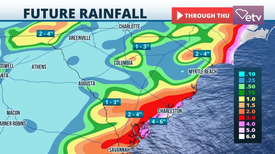
The heightened risk of flash flooding over the Lowcountry and Grand Strand areas have prompted Flash Flood Watches for many areas east of Interstate 95 through Tuesday night. The wet pattern may last occasionally into Saturday, focused primarily on coastal communities.
The National Weather Service said 2 to 4 inches of rain, with some areas receiving more than 6 inches, are possible Tuesday into Tuesday night. Much of this rain could fall in a 3 hour timeframe or less. Motorists are strongly advised to not drive through water-covered roadways, particularly at night when it's harder to judge the depth of the water.

A stalled out front over the state is causing heavy rainfall as far west as the Midlands and even the Upstate Tuesday morning, but will likely begin to move eastward and focus toward the coastline Tuesday afternoon. Conditions may improve for a short time on Wednesday, but the proximity of the front to the coastline will keep the threat of occasionally heavy rain in the forecast through the end of the week.
There are signs that a ridge of high pressure will build over the Southeastern United States from Sunday into next week. If that occurs, a period of drier but potentially hotter weather would return to the state.


